From Martha's Vineyard to Wood's Hole and Cape Cod Canal
- Denise

- Aug 17, 2021
- 4 min read


We felt sad to leave Nantucket behind. Starting the next chapter began with a lovely 26-nautical-mile sail on the Genoa to Martha's Vineyard with 6-10 knots of wind most of the afternoon. The most challenging issue, besides ferry traffic, was the shoals that are plentiful between the two islands. Luckily, with our shallow 3-foot draft and dagger boards up, it wasn't too much of a concern.
But, with a swift current running through the Sound, the water churns when it hits the shallows. Tides and shoals, we've now learned from experience, are so important here on the East Coast!

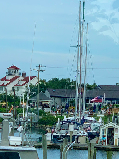
When we pulled into Vineyard Haven, we passed an iconic lighthouse and made our way to the anchorage just beyond the harbor. The launch (water taxi) still services here, and we had a calm night to get some good rest before touring the island the next day.
Beautiful sunrise and sunset in Vineyard Haven
Vineyard Haven was a little disappointing except for gorgeous skies at sunrise and sunset, a delicious Italian Restaurant, and my new favorite shop, The Beach House, which sells imported linens, pottery, and gifts.
Fortunately, Oak Hill was a short bus ride away and Edgartown was not much farther. So we made an afternoon of it. We walked the wharf and didn't see many sailboats in the harbor. The area seemed to cater more to the angler crowd and was probably hopping at night. Just not our cup of tea.
An unexpected find
When we walked up to Ocean Park on the bluff, we discovered the real gems of the island — the ocean view "gingerbread homes" built around the park. They were stunning little "Candy Land" cottages that took us back in time.
History of this unique community
It all began back in 1835 when a Methodist Camp held meetings regularly on half an acre. This location became so popular, that instead of using tents, families began creating their own small and ornate homes. They built something that would reflect well on the community and represent their closeness. Today, it is awe-inspiring to see the details that went into each unique one. Of the original 500 homes, 300 still stand on 34 acres, and they are some of the most sought after and prized real estate today.

We caught the bus back to Vineyard Haven and had an early dinner at Salvatori's, which served excellent Italian! Our visit to Edgartown will have to wait for next time because we planned to depart early the next morning for the notorious "Wood's Hole" — a cut between Nonamesset Island to the south and the town of Woods Hole on the mainland to the north.
An early-morning departure to Wood's Hole


Waters run swiftly through Woods Hole between Vineyard Sound and Buzzard's Bay so you need to time your entrance into the cut going with the tide. If you don't and the winds pick up, it can be treacherous. We planned well, and it was a beautiful calm morning. You could see the currents roiling, and we now know why mariners must heed the warnings about this place. Once through, we headed up into Buzzard's Bay and to the entrance of Cape Cod Canal, a total of 14.9 nautical miles from Vineyard Haven.

This was one of those days we wished we had more experience flying our Spinnaker. The wind was 6 knots with flat water and dead down wind. So, we hoisted the Code D instead with no Main Sail and had to jibe only once. We arrived a little early and anchored for a bit nearby the entrance until the tide was with us, and it was time to go.
Cape Cod Canal
Opened in 1914, the canal connects Buzzard's Bay to Cape Cod Bay and is part of the Atlantic Intracoastal Waterway. It is approximately 7 miles long. The current can change direction every 6 hours and can reach up to 5.2 mph. There are 3 bridges: the Cape Cod Canal Railroad Bridge, the Bourne Bridge, and the Sagamore Bridge. There are traffic lights at either end that govern the approach of vessels 65' and over. All smaller vessels may enter without hailing the canal master.

We had never been through a canal before. We were so excited! The 2.5 knots of current was with us, and we had to keep watching our speed because they have a speed limit of 10 mph (about 8 knots). We left both engines on and were glad we did because there were places that got a little turbulent.
I held my breath for each of the 3 bridges. Then, we were through and safely at our dock at Sandwich Marina, a little fishing harbor just before the other end of the canal.


Our next day was going to be long as we headed all the way up to Boston. So, a fresh seafood dinner, a good wash down of the boat, and a good night's sleep was a great ending to an exciting and successful day.
Look for the next post to follow us to Boston, where we got stuck for a few days preparing to ride out Storm Henri before heading north to Maine.


Comments